Digital Wanderer

We live as long as we fly

Israel — 8, Day 5, the Grandiose Makhtesh Ramon

My faithful electronic assistant got sick, threw a fit, and suffered from sclerosis, which is why this post got lost. Now it will be restored from the annals of my slimy and confused biological memory, which turned out to be more reliable anyway than the magnetic memory of my PC.

Thanks to Mike and his friends, I already had a plan, a route, and valuable pointers. As for the resolve to ride the long version, I acquired that all by myself.

Makhtesh Ramon — that is, the Ramon erosion crater — was formed when water washed away soft rocks. It washed away so much that the crater became the largest of its kind in the world — 9 by 40 kilometers, and half a kilo(meter) deep.  While googling, it quickly caught my attention with its sheer scale, and became to some extent the goal of my trip. As I have repeated more than once, we assign goals and tasks in life to ourselves; there's no super-meaning in them, but having them is pleasant, understandable, and convenient for our buggy brains, which cannot live without constant dopamine injections. Or, for those who like simpler expressions: "IT'S MORE FUN THIS WAY!".

Two thousand years ago, camels scurried through the crater in a line, carrying incense, so it makes sense that they discovered the ruins of a motel under the sign of Khan Saharonim, where Khan means caravanserai in Arabic. Afterward, the crater wasn't famous for anything special, and they mined sand and clay here. Then in the nineties, riding the eco-boom wave, people figured out that a nature reserve would be much more relevant here, especially since hiking and cycling tourism in the country were on the rise.

Of course, the crater has unique flora and fauna, ecology and geology, blah blah blah.

I hit the route, which is part of the National Bike Trail, which will eventually go through the whole country. Only two sections are open so far, but the prospects are encouraging. In the crater, the route is laid out quite cleverly — it's downhill almost the entire time, no need to strain yourself.

A dusty dirt road with patches of asphalt leads through a park area in an arid climate, with rows of trees of varying density and large light stones laid out along the right side.


A light stone monument with inscriptions in English and Hebrew, dedicated to the recreation area and parade ground, as well as Harry O. Triguboff AO, installed in 1985 on sandy ground.

In honor of the best friend of children and athletes the Israeli military, some sponsor from Australia, they set up a little rock

Several partridges are walking along a dirt road against the background of a gently sloping rocky hill. Green trees grow to the left of the road behind a fence of large stones.

The birds were mincing their little legs funnily, but I didn't manage to shoot a video

A large light beige boulder with a blue circular mark on its surface lies on dry rocky ground.

The blue sign of the National Bike Trail — a biker in a circle. A circle with an arrow pointing where to go next

A large information stand with a map, text descriptions, and rules for the "Shvil Yisrael" (Israel Bike Trail) cycling route. The stand is installed outdoors against the backdrop of a dry, rocky desert landscape.

They advise taking a minimum of 5 liters of water a day, and for good reason — even on a winter day, I chugged almost that much

A stone structure made of large flat boulders stacked in the form of columns and floors, on the edge of a rocky cliff in the desert under an overcast sky.

Ducks and cairns mutate in different countries, taking on the most bizarre forms

A clear blue sky with bright sun in the top right corner over a field with sparse trees and several wind turbines on the horizon.

A curve of the gray road leading to the resort paradise of Eilat

A rocky desert under a cloudy sky, in the foreground of which is a metal grid structure filled with a pyramid of stones. In the distance on the horizon, sparse buildings and poles are visible.

Why there are bricks inside is a mystery


A panoramic view of a rocky desert landscape: a road winds along the edge of a cliff, a settlement is visible on the plateau, and mountain ridges can be seen in the distance under an overcast sky.

The Mitzpe I left behind, that is, the observation point

IMG_2003

Curious

A panoramic view from a high, light brown cliff on the left, opening onto a vast desert plain with distant hills, getting lost in the haze under a pale sky.

The foggy haze doesn't let you enjoy the scale

An extensive rocky desert landscape under an overcast sky. In the distance on the horizon, the blurred outlines of a city or industrial settlement are visible.

The path, aka singletrack, is easy to ride, tosses you up a bit, but without anything extreme

A rocky semi-desert valley with gently sloping hills and sparse dry vegetation under a cloudy sky. In the foreground, a dirt path can be seen going into the distance between rocky slopes.

A bit trickier in some places

A relief map made of light stone with engraved mountains, valleys, and roads, labeled in Hebrew and English, installed against a rocky wall. A shadow falls on the map from the left.

We've seen this kind of thing before, and there was even more than one of them here

A clear sky with a bright sun in the top right corner, under which several wind turbines are located on the horizon among sparse trees and fields.

A winding dirt road runs through an arid landscape; a sandy cliff rises on the left, and a rocky hill is visible in the distance under a blue sky with sparse clouds.

There's a cliff right next to it, but hey, it's picturesque

A sandy-rocky hillside with sparse desert vegetation under a clear blue sky, in the upper part of which a dark cave opening is visible.

Holes

A tourist route signpost against the backdrop of a hilly rocky desert landscape under a clear blue sky. Arrows on the pole indicate directions to Mahmal Fort and Mitzpe Ramon in English and Hebrew.

Mike suggested swinging by for the view

A panoramic view of an extensive haze-covered desert landscape under a light sky with thin clouds. A large fragment of a rocky cliff is visible on the right.

The view isn't bad, but it's been like this for the  last twenty kilometers

Ruins of ancient stone structures made of light sandstone on rocky ground, with partially preserved walls and pillars. In the distance, steep rocky mountains are visible under a clear blue sky.

But on the plus side, fort remains

A signpost reading "Noah Ascent" in English and Hebrew is installed in the middle of a desert rocky landscape with sparse dry bushes under a cloudy sky. In the foreground lies a stone marked with a tourist trail marker.

There's a gazillion different tracks around here; how they connect is marked in color on the rocks

A dirt rocky road passes among hills in a desert area under a light sky with thin cirrus clouds.

Now it's wide open

A rocky desert terrain with a winding dirt road running between low hills, and sparse dry bushes under a blue sky.

Now it's narrow

A rocky desert under a clear sky with sparse dry shrubs in the foreground. Gently sloping hills stretch into the distance, and a dirt road winds through the hilly plain.

Now it's narrow in the wide open

A panoramic view of a vast desert landscape with a winding dirt road descending into the valley. Rocky cliffs rise on the right, and hazy mountain ridges are visible on the horizon under a light sky.

And here it is — the long-awaited descent

The descent is incredibly steep, but comfortable — provided you have disc brakes, of course. A few minutes, wet panties - and I'm already way down below.

A dirt rocky road, bordered by stones, goes into the distance across the desert plain towards a mountain range on the horizon under a blue sky with sparse clouds.

Surprisingly rocky here

A rocky desert with sparse dry bushes under a blue sky; mountains and a rising trail of dust in the distance are visible on the horizon.

Could it be a sandworm kicking up dust, rushing to devour me?

A two-seater buggy drives along a dusty dirt road in a hilly desert against the backdrop of distant mountains and power line towers. A black-and-yellow marking post stands in the foreground on the right.

No, just ATV riders having fun

A vast desert landscape with high rocky mountains on the horizon, where two SUVs are driving along a winding dirt road, kicking up clouds of dust.

They face the difficult task of penetrating a tight hole between two rocks

A dusty dirt road goes into the distance through a rocky desert with sparse shrubs. Mountains and power line towers are visible on the horizon under a pale sky with sparse clouds.

As for me  - I'm heading the other way

A long dirt road goes into the distance through a rocky desert area with sparse shrubs, against the backdrop of distant hills and mountains under a light sky.

The intermediate destination is near

A single-story building with a thatched roof, Israeli flags, and a green flag is located on a gravel area. Around it is a desert landscape with rocky hills in the background and several parked cars.

Ta-da! A campground!

At the campground, I wanted to eat a hearty meal, like crazy. Unfortunately, they only sell ice cream and lemonades. Chatted up some biker bros, asked for a screwdriver, otherwise my rack almost fell off from the shaking. They promised a screwdriver for half a buck, to which I parried that in Israel I expected a bigger scam.

IMG_2064

An open recreation area with gravel paving, wooden benches, a bicycle on the left, and a fire pit with ashes in the center foreground. Under a dark fabric canopy are picnic tables with two men sitting at them, against the backdrop of a gently sloping hill.

Those same biker bros, already up there in years

A white helicopter with open doors stands in a desert rocky area against the backdrop of rocky mountains. Next to it are two people, one of whom is photographing the surroundings.

When I pedaled out onto the highway, a chopper rolled up

A desert landscape with several open gazebos with thatched roofs and stone bases, as well as picnic tables on sandy ground. In the background, low rocky hills and several stone buildings are visible, creating the impression of a tourist stop or campground.

What's blissful about the campground is that there's enough water to drown in

IMG_2070

Now here Mike helped a lot with his advice — he strictly ordered me to take this colorful road


A light dirt road winds along a multi-layered rocky cliff in a desert area. Flat mountains are visible on the horizon under a blue sky with light clouds.

Practically an autobahn, smooth and spacious

A high-angle view of a vast desert landscape with rocky hills and distant mountains under a clear blue sky, with a portion of a metal fence in the foreground.

Oftentimes observation points with railings

An extensive rocky landscape with a rusty industrial installation, resembling a long conveyor belt, located in the distance. Conical dumps and a clear blue sky are visible on the horizon.

I have a feeling this is a relic from the times of building material mining

A winding dirt road runs through a desert rocky plain between sandy hills under a clear sky. In the foreground, a rocky slope in shadow is visible, and on the right, two stone slabs standing next to each other stand out.

Zig-zag

An asphalt road with white markings and a yellow shoulder line curves to the right, passing through an arid area. Rocky hills rise on its sides, and flat mountains are visible on the horizon under a blue sky with sparse clouds.

Here, finally, is that same gray ribbon that leads to the top

A deserted asphalt road curves to the left, with guardrails on the sides and a brown "Ramon" sign on the right. Mountains are visible in the distance against a blue sky with sparse clouds.

The Ramon River, as usual in Israel, without a drop of water


A close-up of a man in a black and blue bicycle helmet looking at the camera. In the background, a desert landscape with a road and mountains under a blue sky with sparse clouds is visible.

An old hand looks at you like you're a couch-potato amoeba

An asphalt road with a metal guardrail on the left sharply winds uphill against the backdrop of harsh rocky slopes illuminated by the bright sun breaking through from behind the peak. A sharp turn road sign stands on the right by the road.

From here begins the long road up - three hundred meters of climbing along a steep serpentine

IMG_2103

The day is leaning towards sunset, the desert is colored in tender girlish colors

A blue modular plastic covering with an openwork geometric pattern of radial rays and triangular cells.

It gets cold fast, I shiver, and continue to push on the pedals even more intensely

Two mountain goats stand on a steep rocky slope. One of them is lower and looking back, while the other stands higher on a rocky ledge.

Hippity-hop, and they ran off; how they grip the rocks so deftly with their hooves is beyond me

A winding road in a desert area, surrounded by rocky hills and stone structures on the left, leads under a pedestrian bridge, with streetlights and "Caution, Camels" warning signs along the shoulder.

A Masonic eye and a pedestrian bridge

The three hundred meters didn't come easy, but I've seen worse.

A light rocky cliff in the foreground opens a view of a vast desert landscape with diverse terrain under a soft pastel twilight sky.

Nature is falling asleepIMG_2128

And the electric fireflies are waking up

A dark wall mural, made with chalk, is divided into sections with red and dark blue fields. It depicts stylized figures of people, a tent, a car, hearts, stars, and blue hamsa symbols, as well as a height measurement scale with the number "40".

Positive family graffiti

Two electric ovens, located one above the other, stand on a shelf and a countertop along a gray wall. The top white oven contains bread, and around both ovens on the shelf and countertop are jars with products, a bottle of water, honey, paper towels, and other kitchen utensils.

There are two electric ovens in the house — guess what for?

A block of pressed cottage cheese, partially unwrapped from a crumpled transparent plastic wrap with a white coating, lies on a wooden surface.

An absolutely magical tasting brynza, or something close to it

A cardboard box with groceries: two glass bottles (one with a dark liquid, the other with green), a bunch of bananas, and two packs of wafers. Behind them, a part of another box with the inscription "PILOT Chef" is visible.

A product of the local vineyards

The interior of a filled refrigerator with food on the shelves, among which a pot, a can of canned corn, an egg carton, bottles, and lemons are visible. In the bottom drawers are fresh tomatoes, cucumbers, and other vegetables in packaging.

The fridge contents, the cucumbers have withered completely

A group of empty dark glass beer bottles with red and black labels stands in the corner of a room on a floor with white paint splatters. On the left, the edge of an old sofa is visible, and on the right — several plastic bottles with household chemicals.

Israel does not live by wine alone


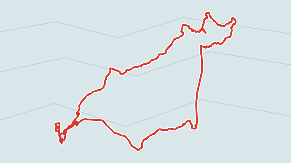
Results of the day. The track isn't hard, and even though I had to sweat a little bit at the end, almost the whole day was a breeze. I rolled 59 km with an elevation gain of almost 900 meters — maybe not a personal record, but considering the heat and the surface, it's quite decent.  The crater is worthy, diverse enough to keep you from getting bored. If the daylight hours had been longer, I could have easily conquered eighty kilometers. It's pleasing that cycle tourism is gaining popularity in the world, and the concept of national trails is going mainstream. I hope that someday a single bike trail will pass through all three Baltic countries, serving as that very unifying thread we've been talking about so much since the very beginning of independence.

P.S. For dessert — an entertaining article about aviation security in Israel.